Ran XIN

Graduate student in City Planning with concentration in Smart Cities | UPenn
One thing I am most proud of myself: Lost 33 lbs in 1 year through persistent physical exercise and healthful diet
View My LinkedIn
Portfolio
Data Analysis and Predictive Modeling
I conducted multiple data analysis projects by using R and Python, and focused on interpreting, engineering data and building models with the principles of machine learning. My projects response to the solutions for real-world concerns in resource allocation.
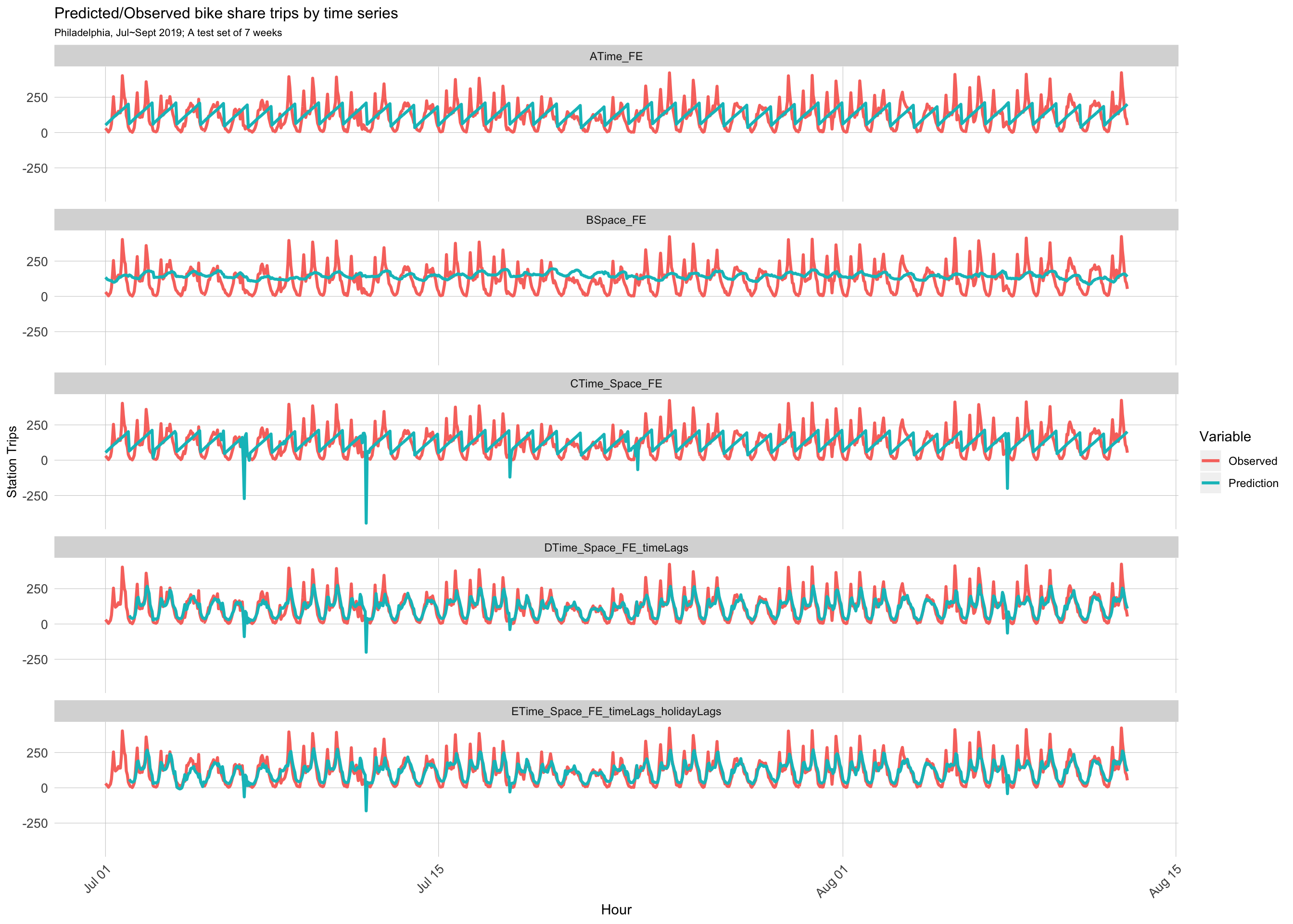
Bike share space-time prediction, Philadelphia
The algorithm model aims to predict Indego bike share demand in Philadelphia by taking time, physical and socio-economic factors into account. The model can assist Indego to better allocate bike resources based on demand varying across time and space.
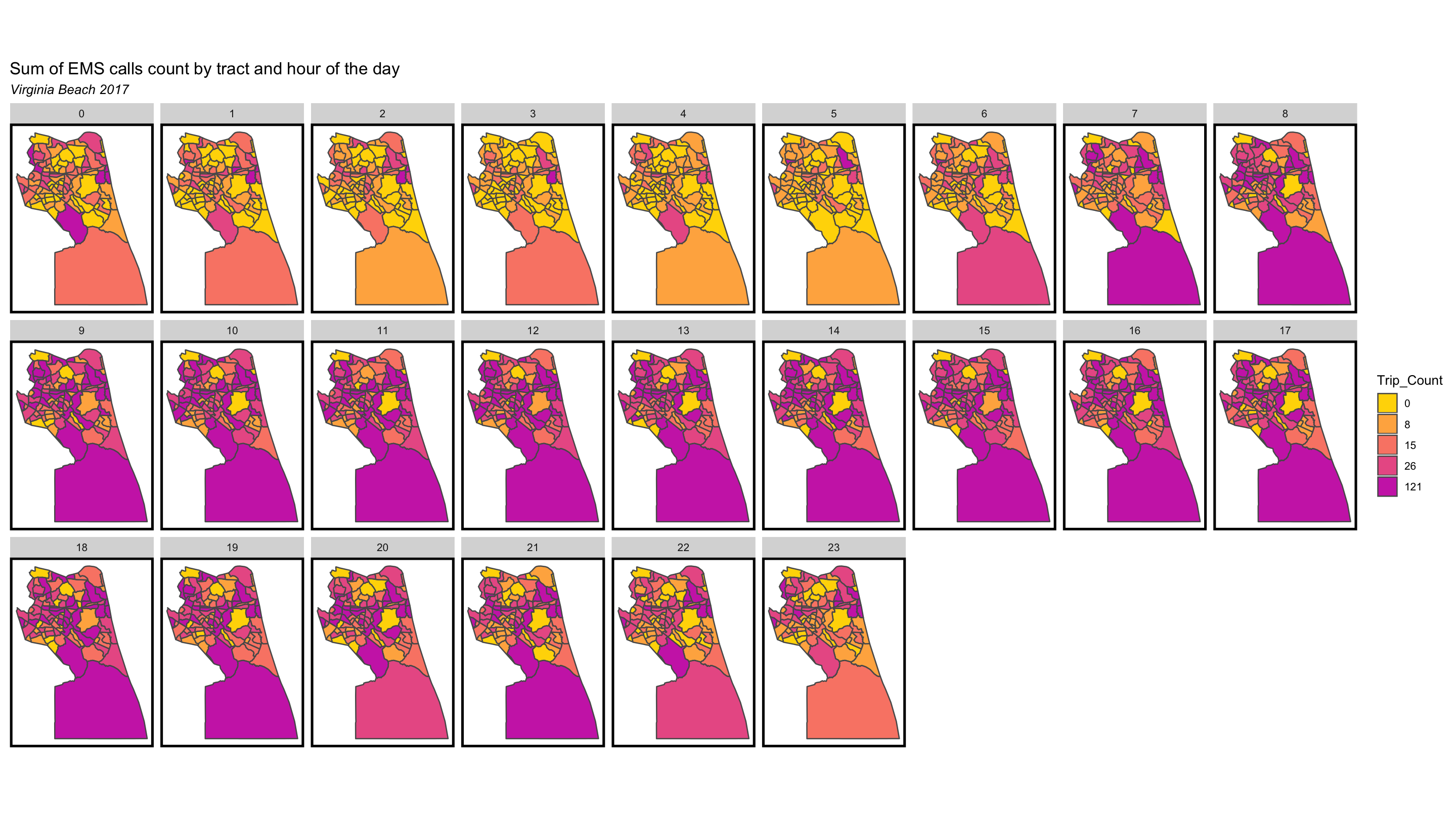
EMS call prediction, Virginia Beach
With existing EMS call records data, this project predicted space and time distribution of future EMS calls by adopting Poisson Regression and Linear Regression, and an APP wireframe was also developed for ambulance drivers by providing the fastest route to direct to the right place based on modeling results.
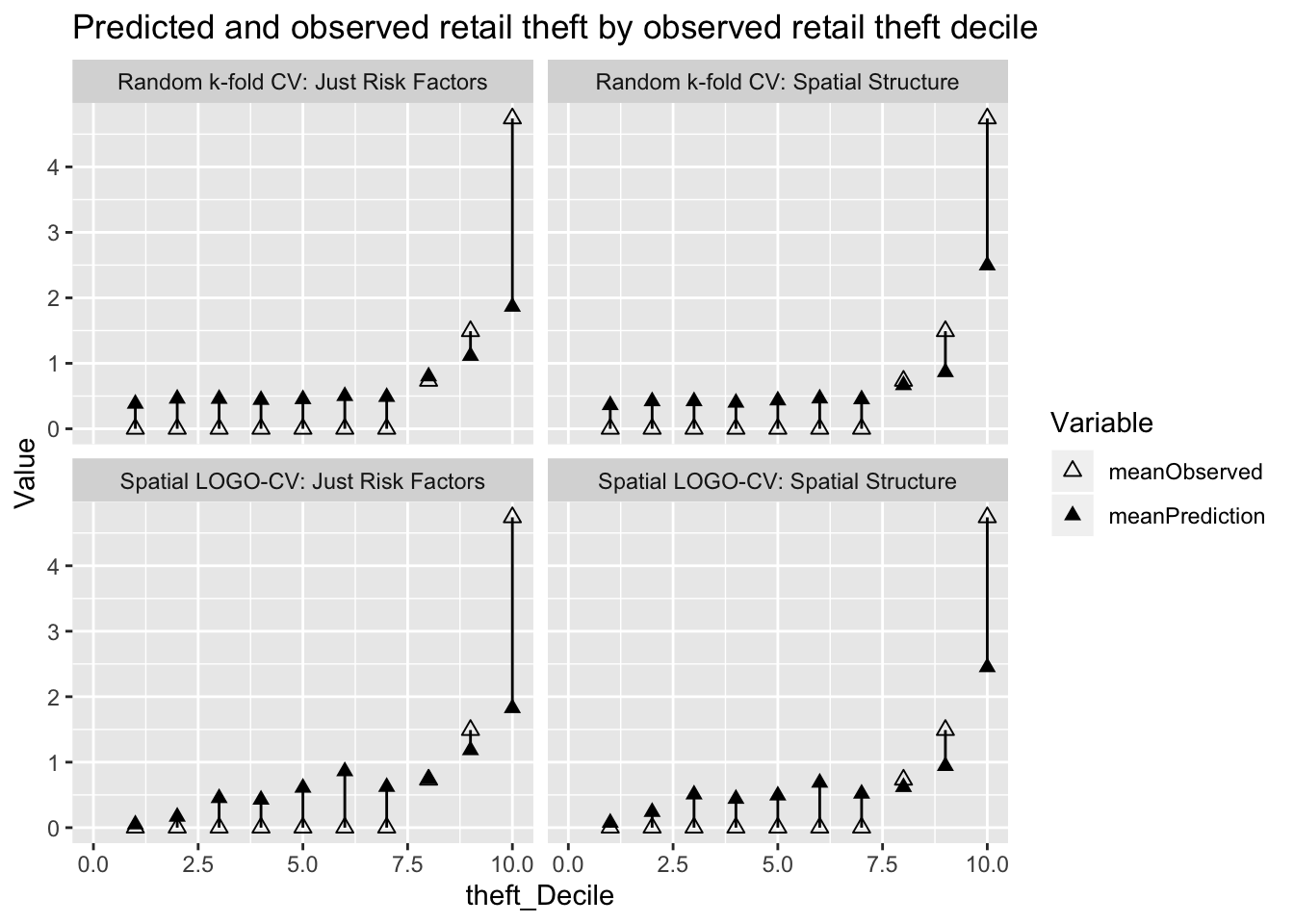
Retail theft risk prediction, Chicago
This project predicts retail theft risk in Chicago based on crime records and various risk factors, and also figures out potential risk hotspots.
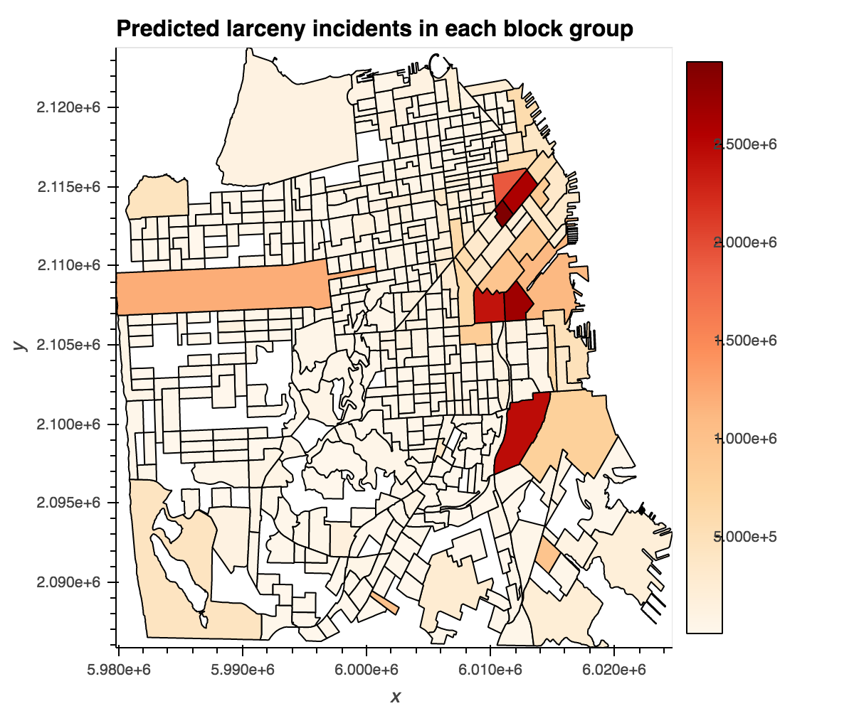
Larcerny index prediction, San Francisco
The Python project predicts larcerny risk in San Francisco by using “larceny index” as the dependent variable. It includes a variety of interactive visuals for exploratory analysis and modeling.
Spatial Analysis
I equipped myself with ArcGIS to conduct spatial analysis for different topics in city and regional planning.
Evaluated the feasibility of TOD along SEPTA metro lines in Philadelphia
Explored the effects of Urban Growth Boundary on building densities and land use
Analyzed the environmental sensitivity of land in Pennsylavnia to assess furture development through raster overlays
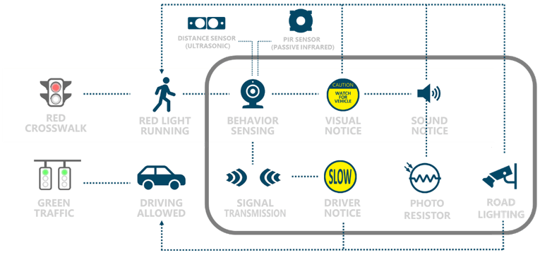
Smart City Project
As a student in Smart Cities concentration, I did a project in improving intersection safety by programming with Arduino for a working prototype. The project is called “SMARTISS-Smart Intersection Safety System”. In brief, the system engages various sensors to detect pedestrains who are crossing the intersection when the traffic light is red, and will remind drivers that are coming towards the intersection.
Cartographic Design
My skill also sets in cartographic design with the ability to complete the cartography in a GIS setting.
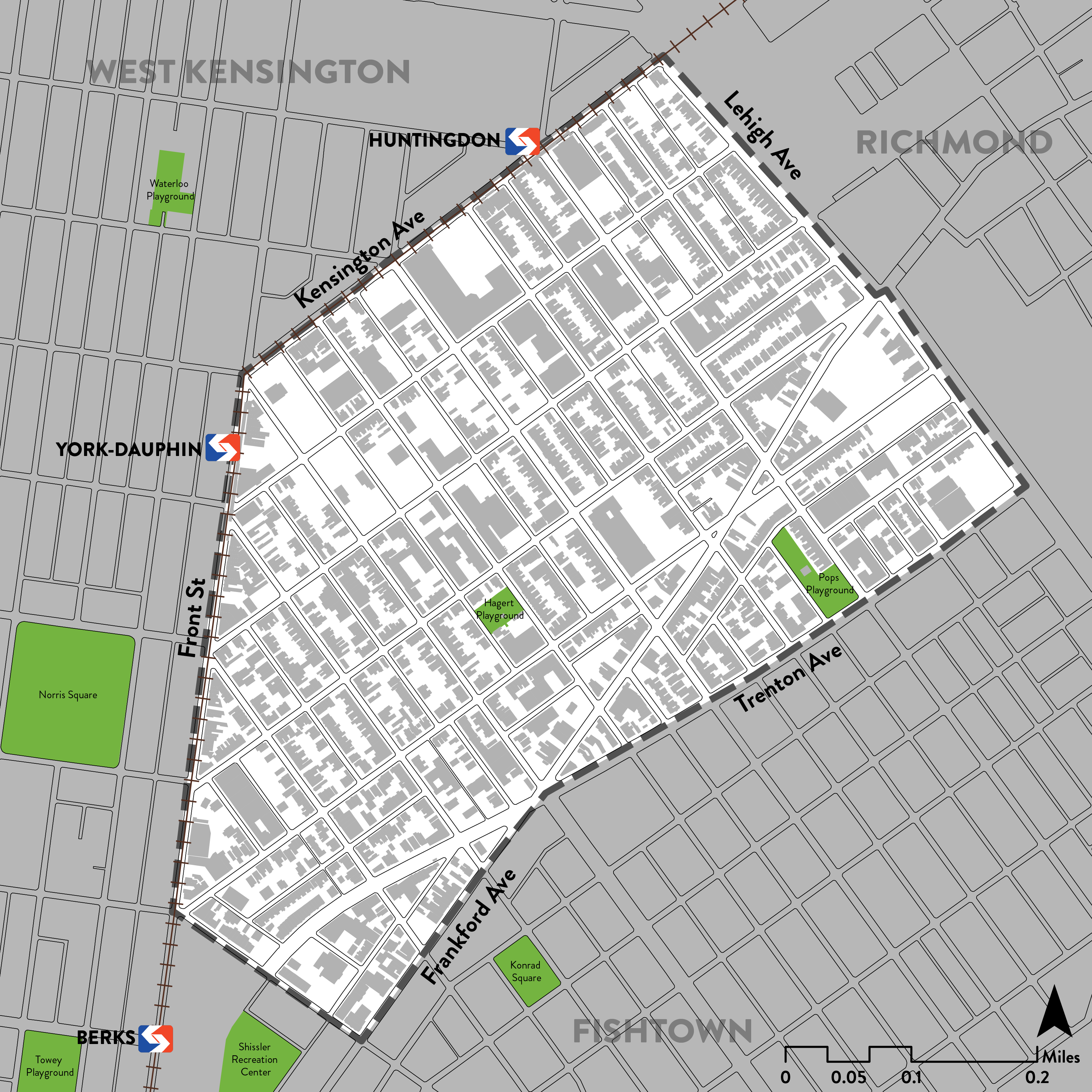
- Basemap: East Kensington neighborhood in Philadelphia
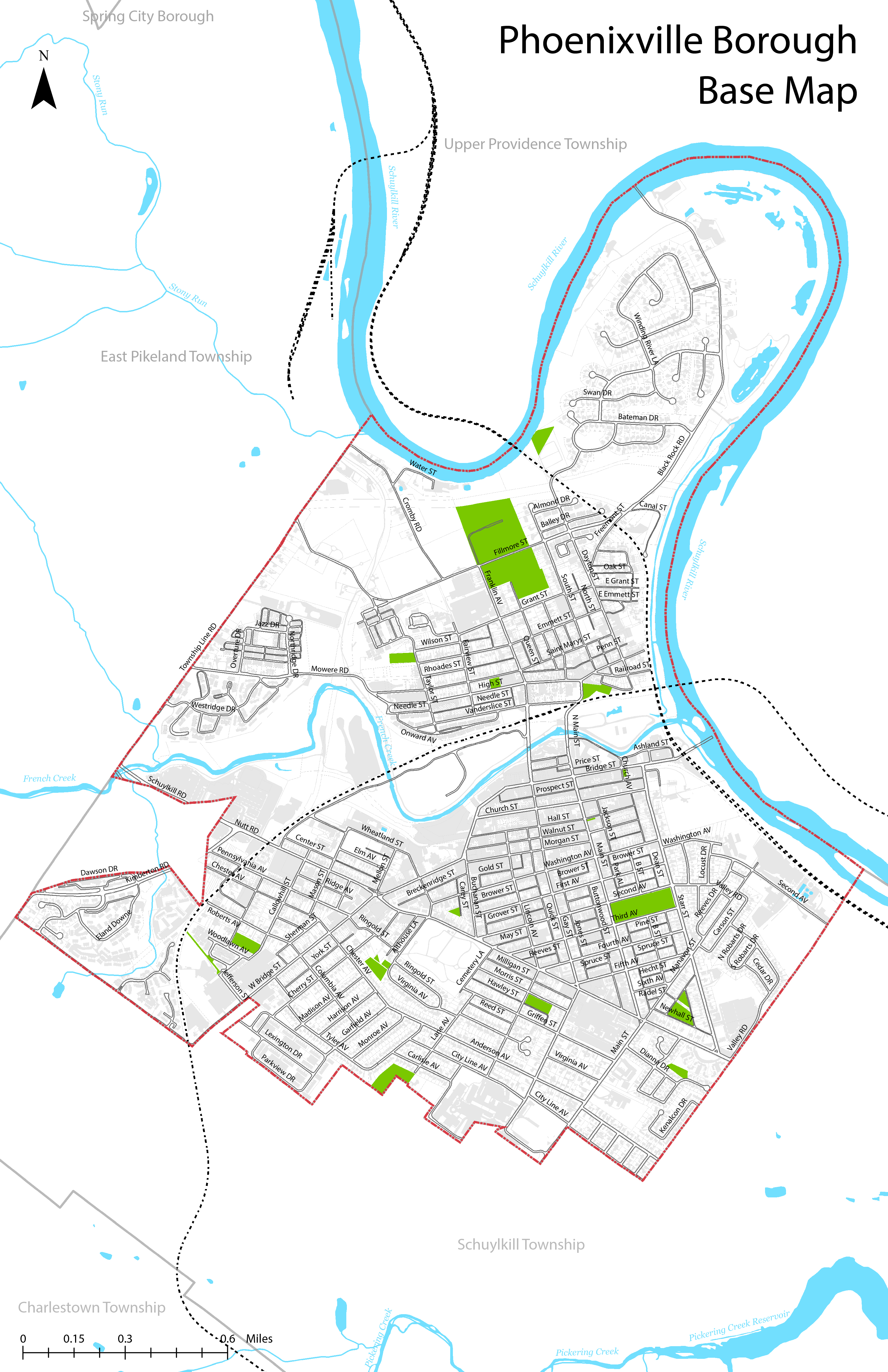
- Basemap: Phoenixville Borough, PA
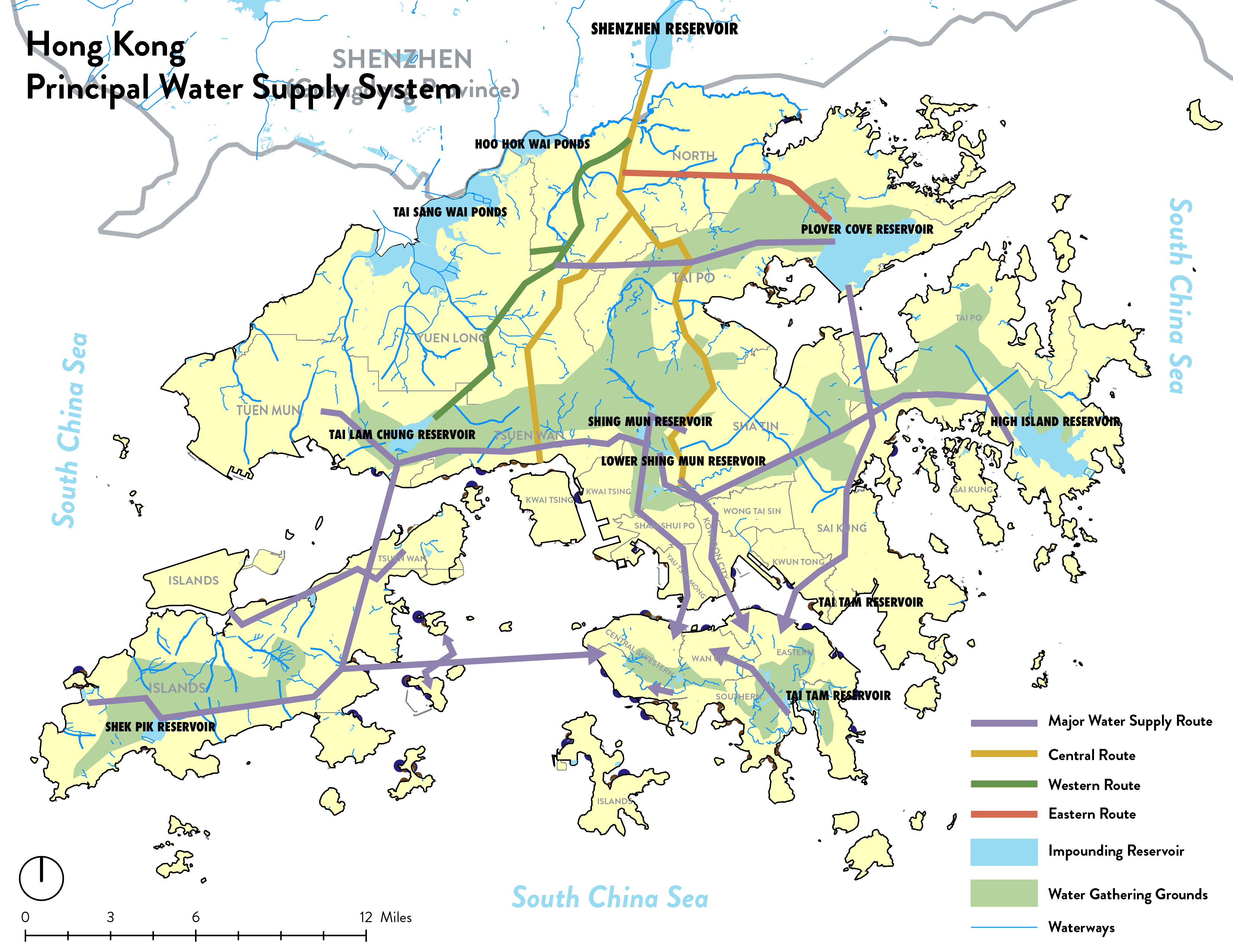
- Map visualization: Hong Kong water supply system
Graphics
With a working knowlege of Adobe Creative Suite, I performed various graphic works. The following images are made in Adobe Illustrator.
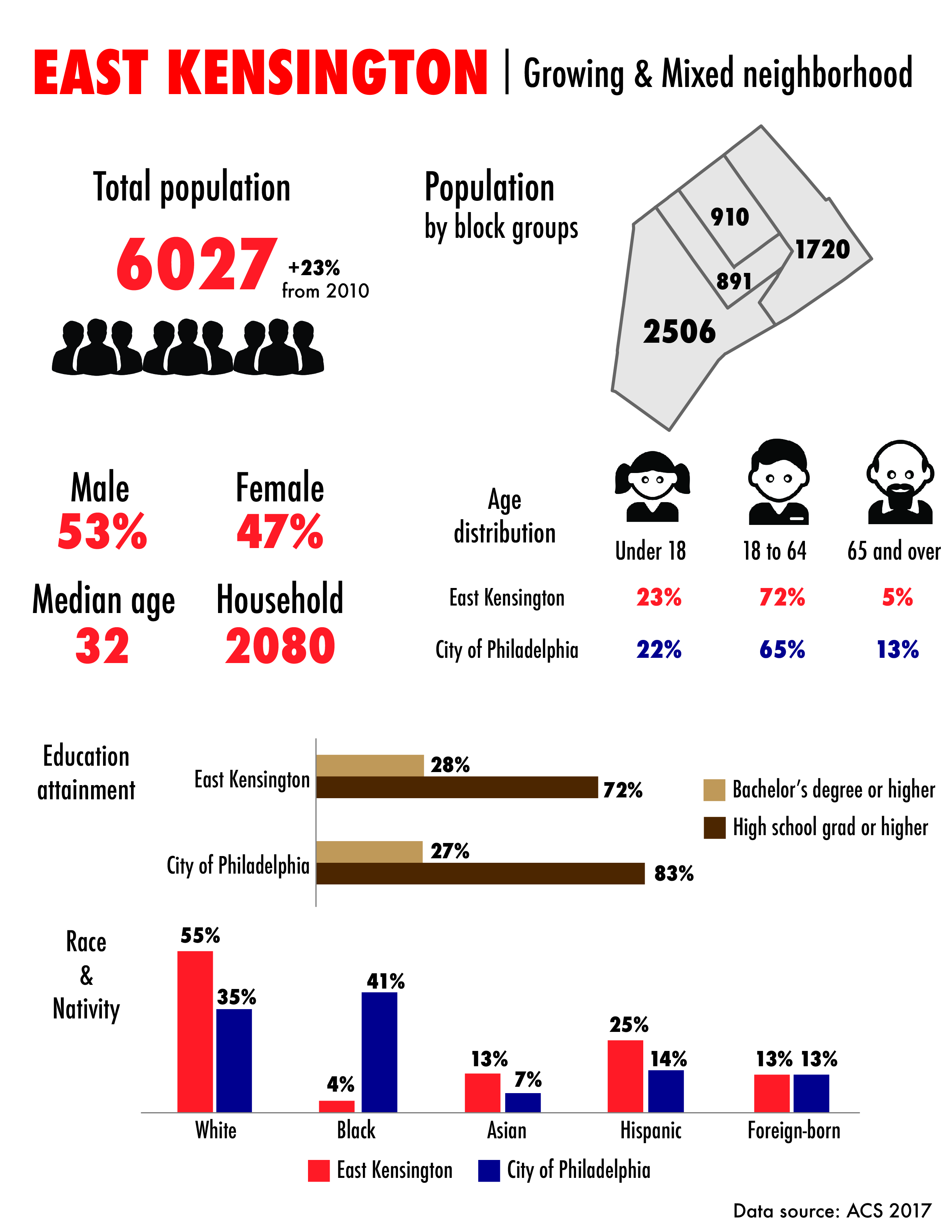
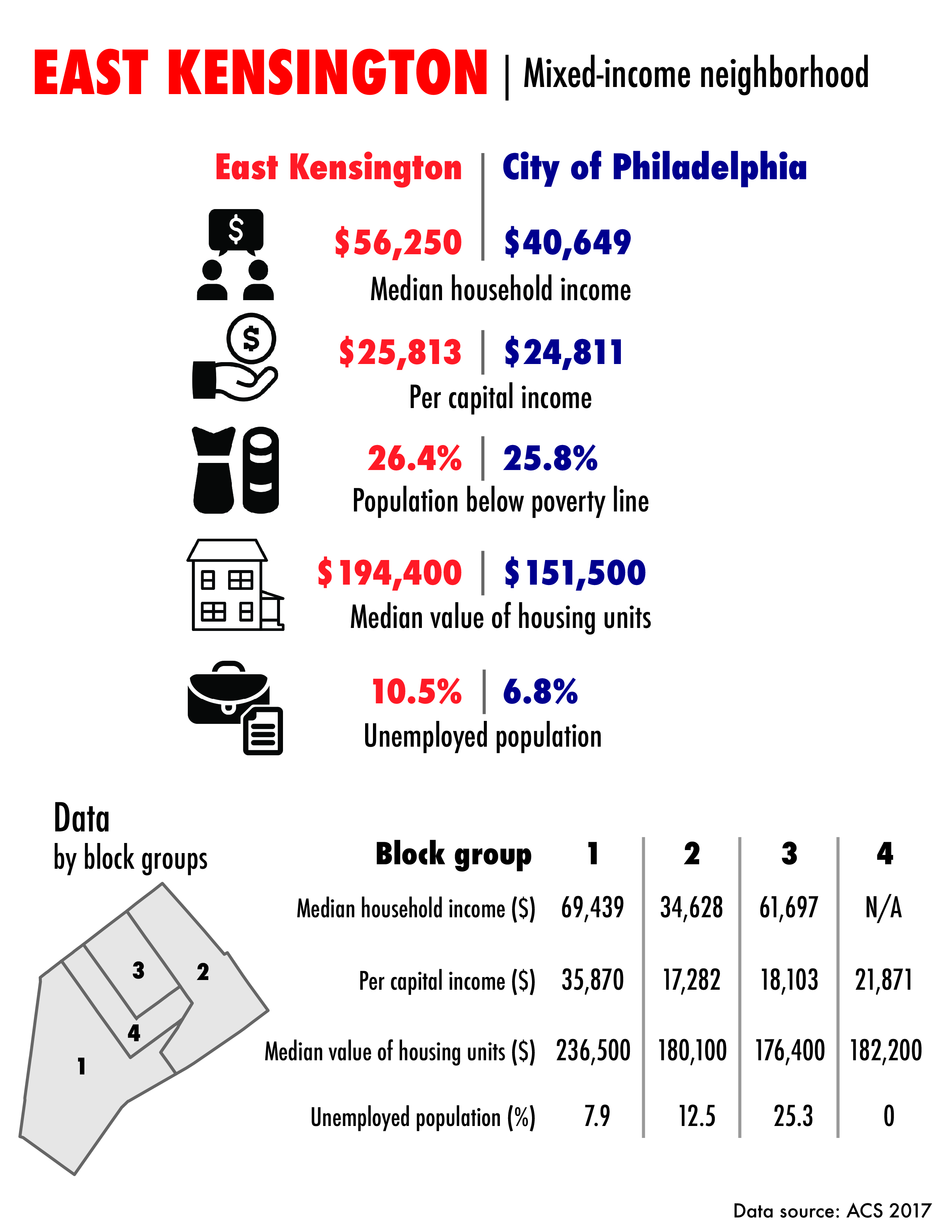
- Infographics for selected demographics of East Kensington neighborhood in Philadelphia
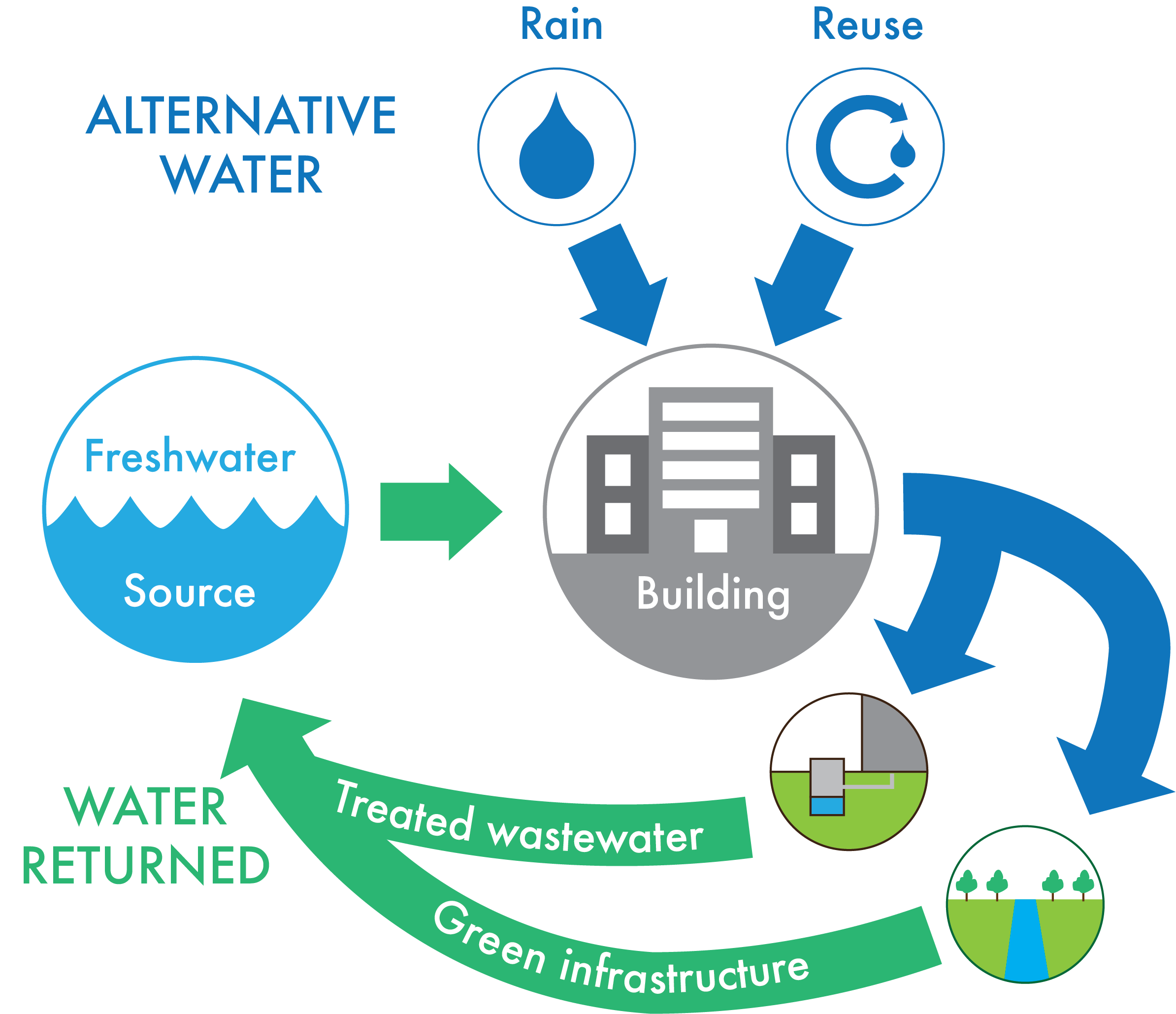
- Diagram for Net Zero Water
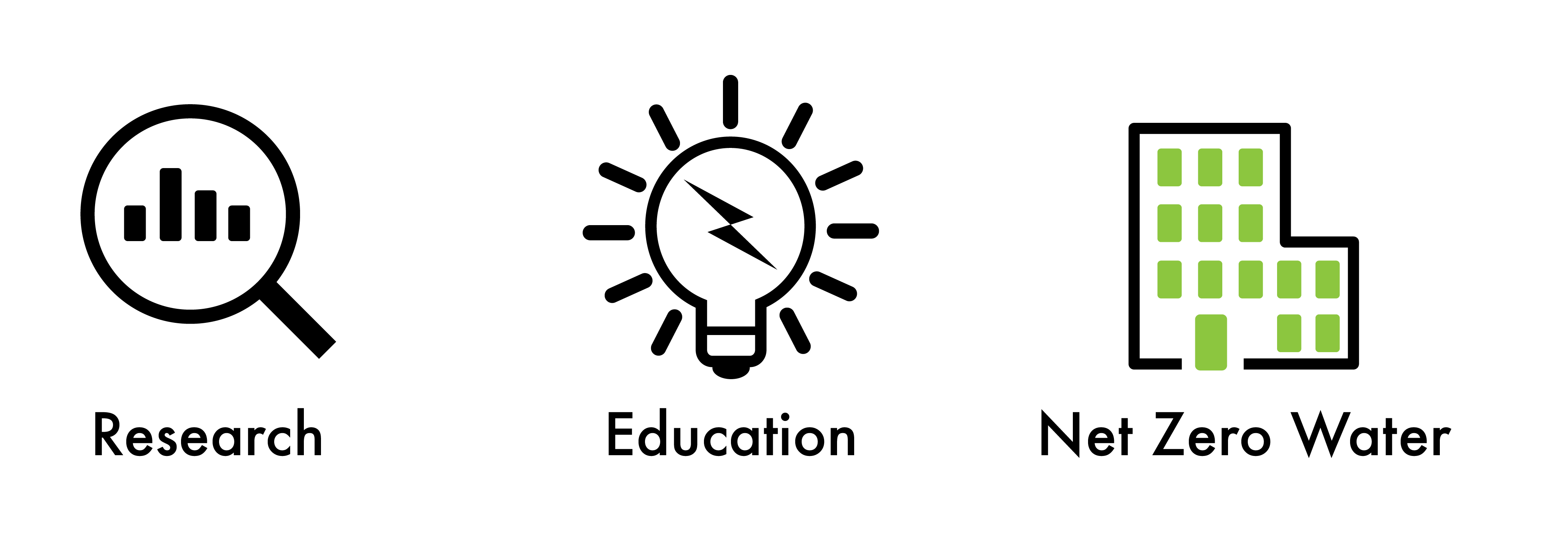
- Miscellaneous icons
Page template forked from evanca